| HOME | | | Overview | | | The Team | | | About | | | Newsletter | | | Contact | | | Links | | | Friends | | | The Novers | | | Benson Hydro | | |

|

|
The Novers Forest Garden Project | Location:
The Novers is an area of regenerated woodland which lies on the south slopes of Titterstone Clee Hill at Knowlegate, approximately 1.5 miles south of Clee Hill village and 3 miles north of the market town of Tenbury Wells.
The Novers: Google Map
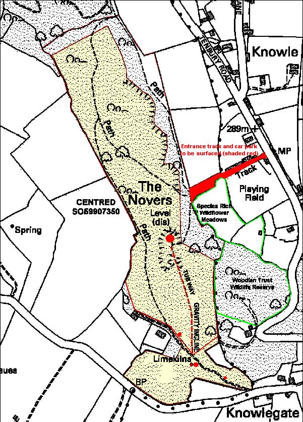
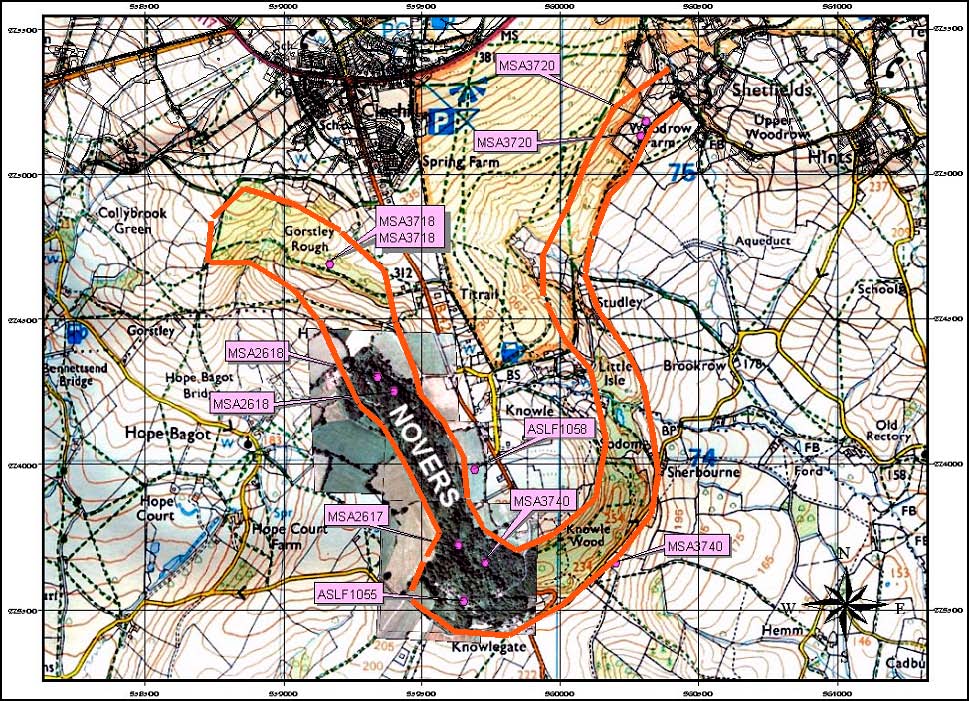
The site lies on the immediate west side of the B4214, centred at grid reference SO59907350. The woodland occupies the south-west slope of a small outlier hill, known locally as Knowle Hill and extends from SO59807340 in the south to SO59607415 in the north with a total area of some 11.4 ha (fig 2). Most of the hillslope has been surface quarried in a series of scooped hollows, following the limestone seam around the hill. These workings are a continuation of an extensive belt of opencast quarrying which follows the outcropping limestone around the south side of Titterstone Clee Hill, commencing near the Cornbrook at SO36047540 running through Knowle Wood and The Novers and ending in Gorstley Rough at SO59167469 (fig 2.).
Fg 2:
As such it is part of an extensive limestone industry which commenced in the 17thc and continued up until the closure of the Gorstley kilns in the 1940s.
Figure 3::