| HOME | | | Overview | | | The Team | | | About | | | Newsletter | | | Contact | | | Links | | | Friends | | | The Novers | | | Benson Hydro | | |

|

|
The Novers Forest Garden Project | Surface Archaeology:
Preliminary Report on the Surface Archaeology and Structures
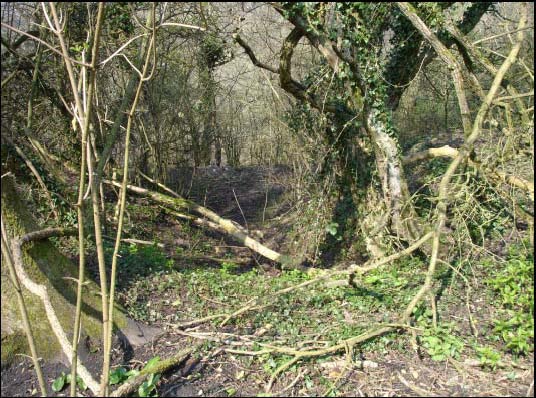
The surviving earthworks and structures at the Novers clearly represent a very full record of the industry and is unique upon the hill, in having in direct association with the early opencast workings, surviving lime kilns, a tramway and incline, and a drift mine. The earliest workings comprise a series of scooped quarries running along the west face of the hill, four in all, linked by a perimeter track-way and roads running into each quarry. There are no stone exposures visible, suggesting either subsequent slumping and erosion or that the whole of the available shallow limestone was removed.
These early quarries are now heavily vegetated with regenerated mixed woodland and provide a valuable wildlife habitat. The earthwork and spoil remains provide a record of the phasing of the workings and from the presence of limestone burning waste, may also contain evidence of early kiln sites.
Following this initial open workings phase there was a drift mine driven in from the bottom of the lowest quarry on a NNW orientation. This latter episode appears to be an attempt to continue the industry once the close to surface limestone resources had been exhausted.
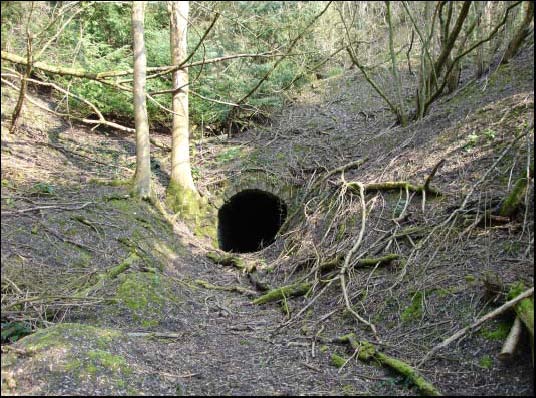
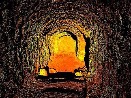
The mine entrance lies at SOSO59637375 and survives well, with a stone built entrance arch 1.8m wide (plate 3). The entrance continues as a barrel vaulted tunnel running roughly NNE for some 20m before being blocked by a fall. It seems probable that the tunnel dips beneath this quarry following the limestone into the hill. Further survey work is required to fully establish this relationship.
Jenkins writing in 1983 gives an account of a conversation with Jim Reynolds a member of the Reynolds family who had worked the mine from the mid 19th century. Mr Reynolds recalls as a boy taking food to the mines and that the tunnel extended for perhaps a mile into the hill and that on the hill above the mine was a ventilation shaft with a ladder, down which the miners would descend to the quarry face (Jenkins 83).
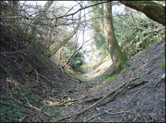
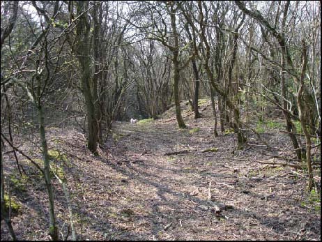
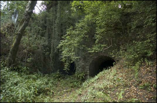
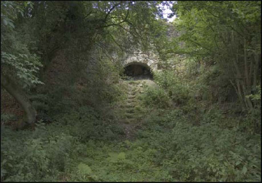
From the mine entrance a causeway (plate 4) with an average width of 1.8mm, probably constructed using spoil from the drift mine, runs roughly SSE for some 135m over and through the earlier open workings to end at the top of a steep incline at SO59667359. This gravity incline (plate 5), 1.8m wide runs for some 74m south to end at SO59667352 (now the entrance way to Kiln House).
At the southern end of the incline is a flattened area between the end of the incline and the two kilns which lie at SO59667350 and SO59677350. This would have been the work area above the charge cones. To the west, centred at SO59617351 is an extensive area of spoil tipping which is probably waste material from the construction of the drift mine. It seems clear that considerable effort was made to construct this mine and from the amount of spoil that is present today, that it is likely to extend for some considerable distance into the hill. There is a second much smaller arched structure at SO59657354 which may also be a drift mine entrance.
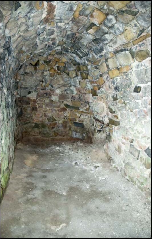
The two substantial lime kilns are constructed into the south slope of the hill. The western kiln has a central cone, in-filled and today recognisable only by a shallow dished hollow 8m in diameter and 0.5m deep This is flanked by two large barrel vaulted discharge vaults of stone construction in an excellent state of preservation, visible below the cone hollow (plate 6).
The top of the more easterly kiln was excavated some time in the 1980s as a project by a local group of historians. This has exposed a substantial stone and brick cone some 8m in diameter and 10m deep. Below the cone is a stone built buttressed archway leading into two barrel vaulted chambers large enough to allow unloading of the processed lime into a cart of some type. The archway is however now blocked by a fall of earth and the remains of the root and trunk of a felled ash tree. The tree has fallen this year and is leaning against the inner face of the arch. There is a danger that this substantial weight pushing against the inner face of the kiln arch could push the arch wall out of alignment, or even cause a collapse. There is therefore an urgent need to remove the tree at the earliest opportunity and to consolidate any structural damage.
These two kilns are thought to be the last phase of the lime works, designed to be fired continuously over a three month period (information C Richards). They clearly represent the remains of a substantial local industry. Below and south of both kilns is a flat work area, which leads into the remains of a hollow way, which would have once linked with the lane to the south.