| HOME | | | Overview | | | The Team | | | About | | | Newsletter | | | Contact | | | Links | | | Friends | | | The Novers | | | Benson Hydro | | |

|

|
Benson's Brook Hydro Scheme | Location
The reservoir itself lies at SO5809,7709 on the west side of Titterstone Clee Hill, in the valley of Benson’s Brook. The Brook itself rises on the south side of the hill and flows as a steeply incised water-course WSW down the SW face of the hill. The site is approached from the A4117 to the south along a lane which runs north from Angel Bank SO572,760, towards the village of Bittereley. A right fork at SO571,770 takes a narrow lane towards Clee Hill summit, approximately one half a mile along this lane is a footpath to the east which follows the course of Benson’s Brook to the reservoir.
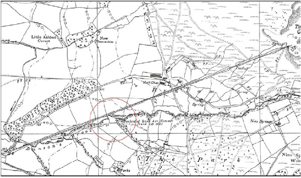
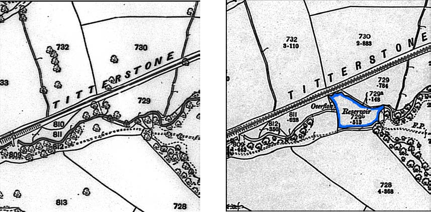
The reservoir itself is a silted triangular pond 60m east to west by 50m north to south, created by damming the course of the brook with a substantial stone walled batter. This feature is not shown on the 1884 OS plan but does appear on the 1903 edition. A reference to excavations for a reservoir in the record of a BA axe find, (HMR UID MSA14309) in 1885 (shown on the map above) seem likely to relate to the reservoir construction.
However a reference in an undated and non-attributed timeline of Titterstone Quarries, chronicling the development of the quarry from 1881 to 1924 has a reference for 1883, that: “The Reservoir and No. 1 Breaking plant was erected at Bittereley”. Jenkins in his 1983 ‘Titterstone Clee Hills’ describes a reservoir near to Titterstone Cottages, being built alongside the incline, the latter being built in advance of the opening of the quarry face. He does not give a date for the reservoir but the implication is that it was built at an early stage of the quarry operations. He goes on to add that the reservoir was part of a hydro scheme which was used to drive turbines which generated power for a stone crusher at Bitterley. This enabled stone to be crushed to the necessary size for the laying of the Bitterley-Titterstone incline. If this is correct it suggests the earlier date for the hydro scheme making it an early application of small scale hydroity generation. Jenkins goes on to explain that although coal would have been available as an energy source the Field and MacKay company had no coal holdings and would have had to purchase supplies from the neighbouring Dhustone or Granite quarries. They preferred to be self contained and so devised a scheme to harness the water resources available to them on the Benson’s Brook (Jenkins 1983, 36).
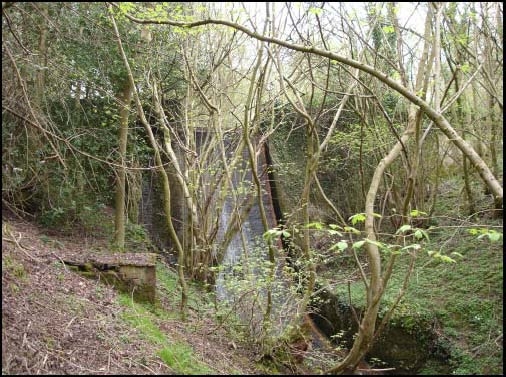
The isolation of the scheme has resulted in the supply side of the scheme surviving largely intact and in an excellent state of preservation. The dam is built across the deep valley of Benson’s Brook between SO58056,77115 on the north side of the valley and SO58069,77072 on the south side giving a total length of 53.5m. The dam wall is concrete faced with dolerite setts 0.9m thick standing to a height of 7.2m above the stream bed. Approximately central along the dam is a 3m wide gap in the wall creating an overflow sluice. This would have probably had a wooden sluice gate, the control mechanism for which remains in situ. The fall from the base of the sluice to the stream bed is 6.2m. and towards the bottom of the dam is a rectangular sluice set into the dam face, possibly being designed to allow the drainage of the head pond.
The Hydro Damn from downstream